GeodeVu: in summary
GeodeVu is designed for geospatial professionals seeking an advanced project management solution. It offers seamless integration with GIS tools and exceptional data visualisation capabilities. Perfect for teams needing precise location-based insights, it stands out with collaborative features and real-time data updates.
What are the main features of GeodeVu?
Seamless Integration with GIS Tools
GeodeVu enables efficient collaboration by integrating smoothly with existing GIS tools, enhancing geospatial data workflows and improving productivity.
- Data Synchronisation: Automatically updates and synchronises geospatial data across platforms.
- Tool Compatibility: Works flawlessly with popular GIS software, reducing transition friction.
- API Access: Provides an API for custom integrations and additional functionality.
Advanced Data Visualisation
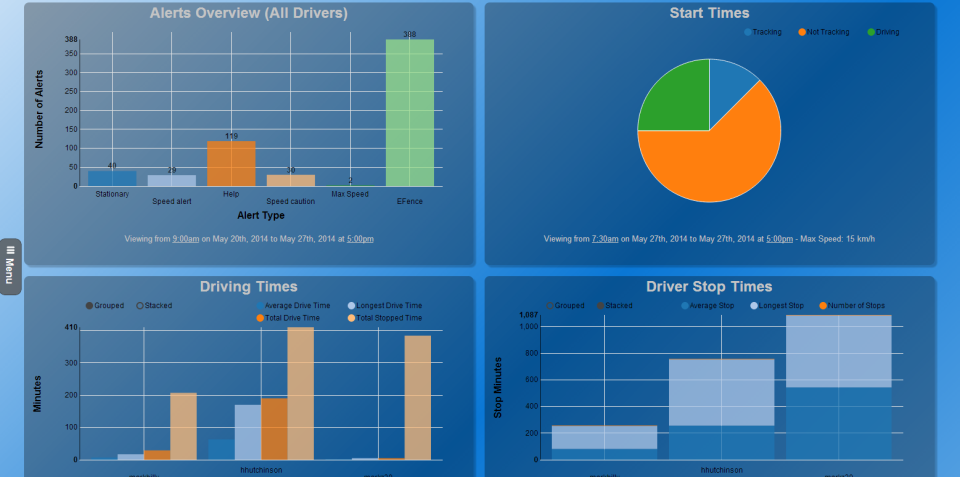
With GeodeVu, you can transform complex geospatial data into intuitive visual displays, empowering users to make informed decisions quickly.
- Dynamic Maps: Offers real-time maps that update based on live data inputs.
- Customisable Dashboards: Tailor your visual interface to highlight key metrics and insights.
- 3D Modelling: Create immersive 3D geospatial models for comprehensive analysis.
Collaborative Features for Teams
Facilitate seamless teamwork with GeodeVu's suite of collaborative tools designed for geospatial professionals working in tandem.
- Shared Workspaces: Create and manage shared project spaces for team collaboration.
- Real-Time Updates: Keep everyone on the same page with instant data updates.
- Communication Tools: Integrated chat and video conferencing for efficient team communication.

GeodeVu: its rates
standard Rate On demand |
|---|
Clients alternatives to GeodeVu
Appvizer Community Reviews (0)
No reviews, be the first to submit yours.


